
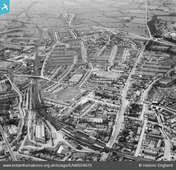
EAW004670 ENGLAND (1947). Friargate and environs, Derby, from the east, 1947
© Copyright OpenStreetMap contributors and licensed by the OpenStreetMap Foundation. 2026. Cartography is licensed as CC BY-SA.
Nearby Images (5)
EAW004670

EAW044085

EAW004668

EAW004667

EAW004671

Details
| Title | [EAW004670] Friargate and environs, Derby, from the east, 1947 |
| Reference | EAW004670 |
| Date | 22-April-1947 |
| Link | |
| Place name | DERBY |
| Parish | |
| District | |
| Country | ENGLAND |
| Easting / Northing | 434442, 336386 |
| Longitude / Latitude | -1.4876400307505, 52.923463945679 |
| National Grid Reference | SK344364 |
Pins

gerry-r |
Saturday 10th of August 2024 06:28:05 PM | |
|
gerry-r |
Saturday 10th of August 2024 06:27:18 PM | |
|
redmist |
Wednesday 25th of October 2023 09:11:04 PM | |
|
Katie C |
Monday 10th of February 2014 02:32:58 PM | |
|
Marco1968 |
Sunday 19th of January 2014 10:47:03 AM | |

Peter Kazmierczak |
Tuesday 15th of October 2013 10:34:52 PM | |
|
Spstoney |
Sunday 15th of September 2013 07:46:11 PM | |
|
Peter Kazmierczak |
Saturday 14th of September 2013 12:42:45 AM | |
|
Peter Kazmierczak |
Saturday 14th of September 2013 12:41:19 AM | |
|
Peter Kazmierczak |
Saturday 14th of September 2013 12:40:16 AM | |
|
Peter Kazmierczak |
Saturday 14th of September 2013 12:38:54 AM |