
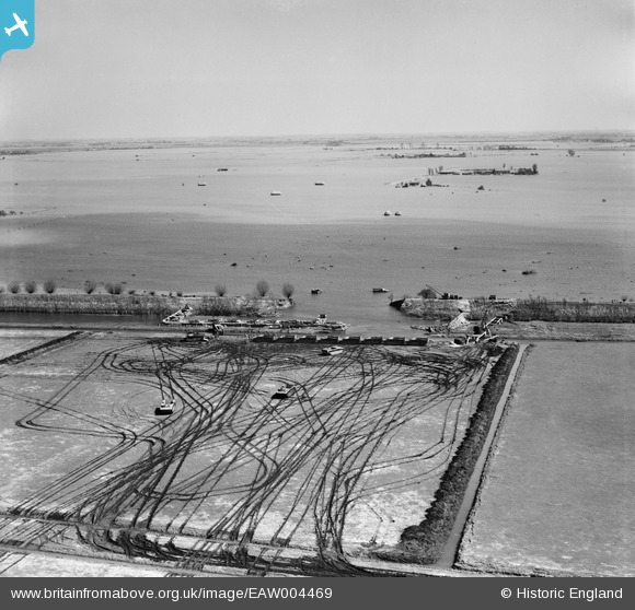
EAW004469 ENGLAND (1947). A breach in the Wash Bank undergoing emergency repairs, Crowland Fodder Lots, from the west, 1947
© Copyright OpenStreetMap contributors and licensed by the OpenStreetMap Foundation. 2026. Cartography is licensed as CC BY-SA.
Nearby Images (4)
EAW004469

EAW004468

EAW004473

EAW004471

Details
| Title | [EAW004469] A breach in the Wash Bank undergoing emergency repairs, Crowland Fodder Lots, from the west, 1947 |
| Reference | EAW004469 |
| Date | 16-April-1947 |
| Link | |
| Place name | CROWLAND |
| Parish | CROWLAND |
| District | |
| Country | ENGLAND |
| Easting / Northing | 523746, 312433 |
| Longitude / Latitude | -0.16869753214778, 52.695074552554 |
| National Grid Reference | TF237124 |
Pins
Be the first to add a comment to this image!