
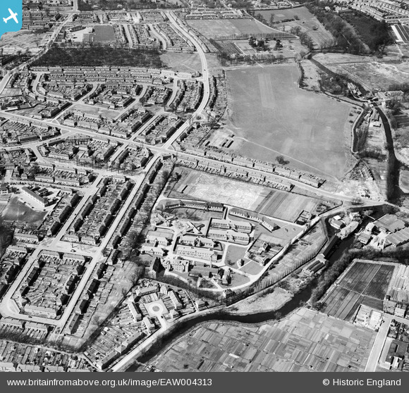
EAW004313 ENGLAND (1947). The Wandle Valley Isolation Hospital and the surrounding residential area, St Helier, 1947
© Copyright OpenStreetMap contributors and licensed by the OpenStreetMap Foundation. 2026. Cartography is licensed as CC BY-SA.
Nearby Images (4)
EAW004313

EAW004314

EAW004315

EPW025114

Details
| Title | [EAW004313] The Wandle Valley Isolation Hospital and the surrounding residential area, St Helier, 1947 |
| Reference | EAW004313 |
| Date | 11-April-1947 |
| Link | |
| Place name | ST HELIER |
| Parish | |
| District | |
| Country | ENGLAND |
| Easting / Northing | 527621, 166771 |
| Longitude / Latitude | -0.16578027891009, 51.38512052153 |
| National Grid Reference | TQ276668 |
Pins

Patrickcaseyy0 |
Saturday 4th of October 2025 10:45:22 PM | |

Matt Aldred edob.mattaldred.com |
Thursday 3rd of April 2025 02:05:30 PM | |
|
christhewino |
Monday 9th of January 2023 10:23:17 PM | |
|
christhewino |
Monday 9th of January 2023 10:22:18 PM | |
|
christhewino |
Monday 9th of January 2023 10:20:14 PM | |
|
christhewino |
Monday 9th of January 2023 10:19:30 PM | |
|
Norvian |
Tuesday 28th of January 2014 05:05:00 PM | |
|
Laurie |
Friday 17th of January 2014 11:37:11 AM | |
|
Hicksy |
Tuesday 14th of January 2014 11:57:58 AM | |
|
Hicksy |
Tuesday 14th of January 2014 11:57:18 AM | |
This is Wood Street |
Norvian |
Tuesday 28th of January 2014 05:06:21 PM |
|
Hicksy |
Tuesday 14th of January 2014 11:56:49 AM |