
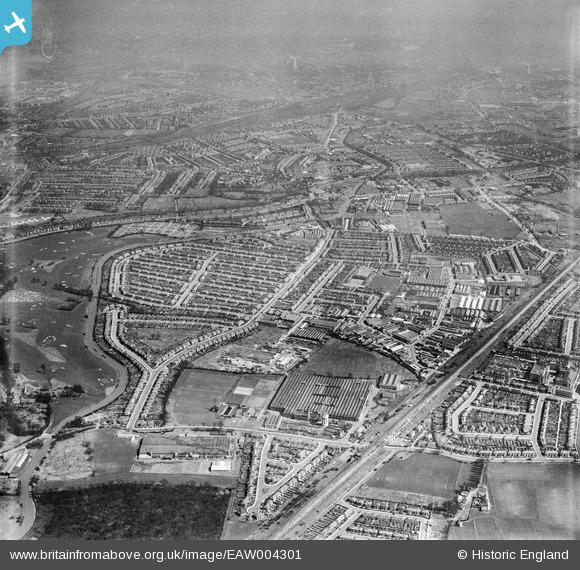
EAW004301 ENGLAND (1947). The Perivale Industrial Park and the surrounding residential area, Perivale, from the west, 1947
© Copyright OpenStreetMap contributors and licensed by the OpenStreetMap Foundation. 2026. Cartography is licensed as CC BY-SA.
Nearby Images (18)
EAW004301

EPW029368

EPW029364

EPW032175

EPW029369

EPW029365

EAW004299

EPW029370

EPW035509

EPW029372

EPW035508

EAW004296

EPW029373

EPW029371

EPW029363

EPW029367

EPW029366

EAW004303

Details
| Title | [EAW004301] The Perivale Industrial Park and the surrounding residential area, Perivale, from the west, 1947 |
| Reference | EAW004301 |
| Date | 11-April-1947 |
| Link | |
| Place name | PERIVALE |
| Parish | |
| District | |
| Country | ENGLAND |
| Easting / Northing | 516482, 183533 |
| Longitude / Latitude | -0.320273711245, 51.538185248169 |
| National Grid Reference | TQ165835 |
Pins

Ealing Parks |
Thursday 5th of November 2020 05:13:47 PM | |

Des Elmes |
Monday 11th of April 2016 02:48:52 AM | |
|
Des Elmes |
Monday 11th of April 2016 02:47:56 AM | |
|
Des Elmes |
Monday 11th of April 2016 02:46:43 AM | |
|
SimonRoberts |
Monday 11th of November 2013 03:59:40 PM |
