
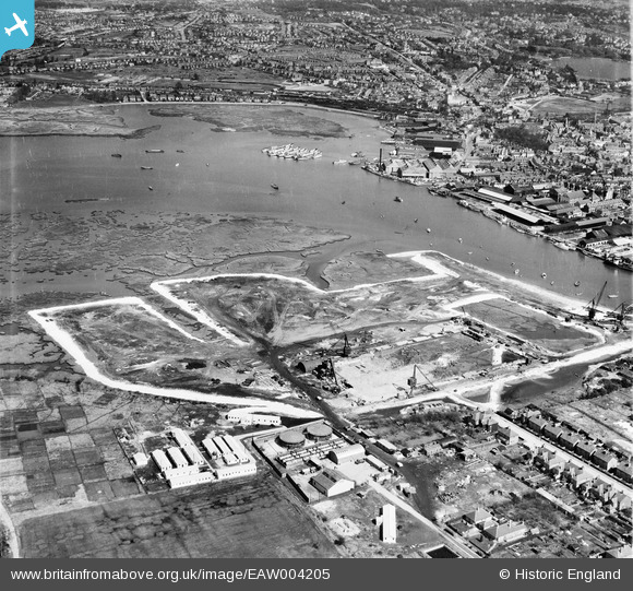
EAW004205 ENGLAND (1947). Land reclamation at the site of Hamworthy Power Station, Poole, from the south-west, 1947
© Copyright OpenStreetMap contributors and licensed by the OpenStreetMap Foundation. 2026. Cartography is licensed as CC BY-SA.
Nearby Images (24)
EAW004205

EAW004196

EAW004200

EAW019946

EAW004208

EAW004207

EAW019948

EAW019947

EAW004197

EAW019950

EAW019955

EAW019954

EAW004201

EAW019944

EAW004195

EAW004198

EAW019949

EAW019953

EAW004206

EAW004199

EAW004209

EAW004204

EAW019951

EAW019945

Details
| Title | [EAW004205] Land reclamation at the site of Hamworthy Power Station, Poole, from the south-west, 1947 |
| Reference | EAW004205 |
| Date | 10-April-1947 |
| Link | |
| Place name | POOLE |
| Parish | |
| District | |
| Country | ENGLAND |
| Easting / Northing | 400155, 90581 |
| Longitude / Latitude | -1.9978043119494, 50.714285168786 |
| National Grid Reference | SZ002906 |
Pins

redmist |
Sunday 9th of August 2020 11:21:54 AM | |
|
redmist |
Sunday 9th of August 2020 11:17:51 AM | |
|
redmist |
Sunday 9th of August 2020 11:16:38 AM | |
|
redmist |
Sunday 9th of August 2020 11:16:13 AM | |
|
Graham Yaxley |
Wednesday 17th of December 2014 04:35:55 PM |