
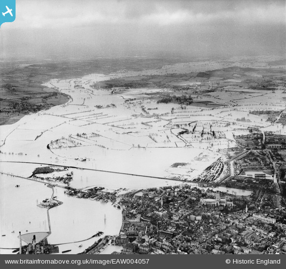
EAW004057 ENGLAND (1947). Flooding along the River Severn, Gloucester, from south, 1947
© Copyright OpenStreetMap contributors and licensed by the OpenStreetMap Foundation. 2026. Cartography is licensed as CC BY-SA.
Nearby Images (2)
EAW004057

EPW038352

Details
| Title | [EAW004057] Flooding along the River Severn, Gloucester, from south, 1947 |
| Reference | EAW004057 |
| Date | 21-March-1947 |
| Link | |
| Place name | GLOUCESTER |
| Parish | |
| District | |
| Country | ENGLAND |
| Easting / Northing | 382667, 219292 |
| Longitude / Latitude | -2.251785719275, 51.871491427321 |
| National Grid Reference | SO827193 |
Pins
Be the first to add a comment to this image!