
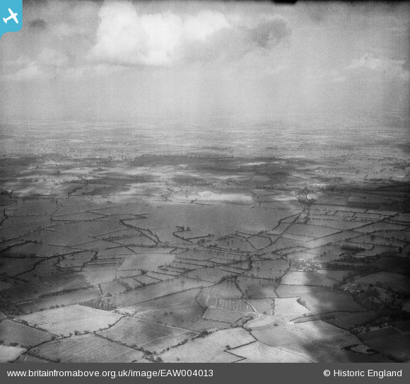
EAW004013 ENGLAND (1947). Flooding at Longdon Marsh and Marsh End, Longdon, from the south-west, 1947
© Copyright OpenStreetMap contributors and licensed by the OpenStreetMap Foundation. 2026. Cartography is licensed as CC BY-SA.
Nearby Images (2)
EAW004013

EAW004012

Details
| Title | [EAW004013] Flooding at Longdon Marsh and Marsh End, Longdon, from the south-west, 1947 |
| Reference | EAW004013 |
| Date | 21-March-1947 |
| Link | |
| Place name | LONGDON |
| Parish | LONGDON |
| District | |
| Country | ENGLAND |
| Easting / Northing | 381530, 235707 |
| Longitude / Latitude | -2.269184147532, 52.019054095913 |
| National Grid Reference | SO815357 |
Pins

User Comment Contributions
Thanks for the pins Class31. We'll update the catalogue and post your new data here in due course. Yours, Katy Britain from Above Cataloguing Team Leader |
Katy Whitaker |
Tuesday 3rd of September 2013 12:59:56 PM |