
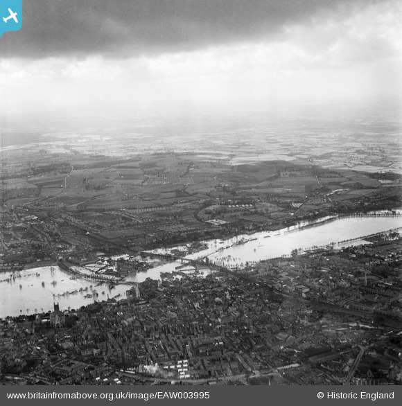
EAW003995 ENGLAND (1947). Flooding along the River Severn around Worcester Bridge and the railway viaduct, Worcester, from the east, 1947
© Copyright OpenStreetMap contributors and licensed by the OpenStreetMap Foundation. 2026. Cartography is licensed as CC BY-SA.
Nearby Images (3)
EAW003995

EPW035912

EPW035915

Details
| Title | [EAW003995] Flooding along the River Severn around Worcester Bridge and the railway viaduct, Worcester, from the east, 1947 |
| Reference | EAW003995 |
| Date | 21-March-1947 |
| Link | |
| Place name | WORCESTER |
| Parish | |
| District | |
| Country | ENGLAND |
| Easting / Northing | 384090, 255294 |
| Longitude / Latitude | -2.2327900227284, 52.195249990874 |
| National Grid Reference | SO841553 |
Pins

kevin Poole |
Sunday 29th of December 2013 11:35:12 PM | |
|
kevin Poole |
Sunday 29th of December 2013 11:33:27 PM | |
|
kevin Poole |
Sunday 29th of December 2013 11:31:40 PM | |
|
kevin Poole |
Sunday 29th of December 2013 11:29:23 PM | |
|
kevin Poole |
Sunday 29th of December 2013 11:28:18 PM | |
|
mjmuk |
Friday 23rd of August 2013 06:46:38 PM | |
|
mjmuk |
Friday 23rd of August 2013 06:45:30 PM | |
|
mjmuk |
Friday 23rd of August 2013 06:44:40 PM |