
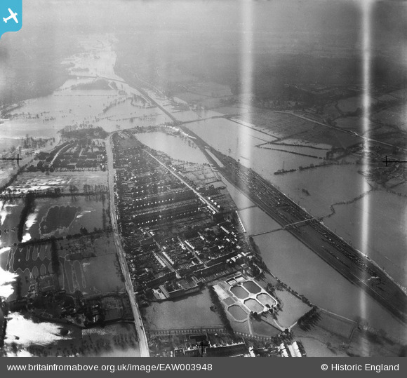
EAW003948 ENGLAND (1947). New Hinksey and surrounding flooding, New Hinksey, from the north, 1947. This image has been produced from a damaged negative.
© Copyright OpenStreetMap contributors and licensed by the OpenStreetMap Foundation. 2026. Cartography is licensed as CC BY-SA.
Nearby Images (2)
EAW003948

EAW038161
, Oxford, 1951. This image has been produced from a damaged negative.")
Details
| Title | [EAW003948] New Hinksey and surrounding flooding, New Hinksey, from the north, 1947. This image has been produced from a damaged negative. |
| Reference | EAW003948 |
| Date | 20-March-1947 |
| Link | |
| Place name | NEW HINKSEY |
| Parish | |
| District | |
| Country | ENGLAND |
| Easting / Northing | 451492, 204836 |
| Longitude / Latitude | -1.2541863064475, 51.739405619386 |
| National Grid Reference | SP515048 |
Pins

alan_mac |
Wednesday 8th of January 2014 05:15:03 PM |