
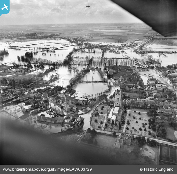
EAW003729 ENGLAND (1947). Flooding surrounding St Mary's Church, St Neots, from the east, 1947
© Copyright OpenStreetMap contributors and licensed by the OpenStreetMap Foundation. 2026. Cartography is licensed as CC BY-SA.
Nearby Images (8)
EAW003729

EAW033048

EAW033049

EAW033052

EAW033051

EAW033050

EAW003728

EPW028952

Details
| Title | [EAW003729] Flooding surrounding St Mary's Church, St Neots, from the east, 1947 |
| Reference | EAW003729 |
| Date | 18-March-1947 |
| Link | |
| Place name | ST NEOTS |
| Parish | ST. NEOTS |
| District | |
| Country | ENGLAND |
| Easting / Northing | 518472, 260121 |
| Longitude / Latitude | -0.26528849731297, 52.226133160191 |
| National Grid Reference | TL185601 |
Pins

NickA |
Friday 11th of June 2021 11:40:30 AM |