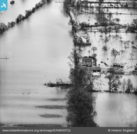
EAW003711 ENGLAND (1947). Eton Great Common under floodwater, Eton, 1947
© Copyright OpenStreetMap contributors and licensed by the OpenStreetMap Foundation. 2026. Cartography is licensed as CC BY-SA.
Details
| Title | [EAW003711] Eton Great Common under floodwater, Eton, 1947 |
| Reference | EAW003711 |
| Date | 18-March-1947 |
| Link | |
| Place name | ETON |
| Parish | ETON |
| District | |
| Country | ENGLAND |
| Easting / Northing | 495581, 178439 |
| Longitude / Latitude | -0.62295402960121, 51.496318065118 |
| National Grid Reference | SU956784 |
Pins

Class31 |
Friday 13th of September 2013 11:06:32 PM | |

Class31 |
Friday 13th of September 2013 10:57:52 PM | |

Class31 |
Friday 13th of September 2013 10:56:16 PM | |

Class31 |
Friday 13th of September 2013 10:51:33 PM | |

Class31 |
Friday 13th of September 2013 10:50:21 PM |
User Comment Contributions
Thanks for spending time on the image - we'll update the catalogue with the new information and post the updated record here in due course. Yours, Katy Britain from Above Cataloguing Team Leader |
Katy Whitaker |
Friday 1st of November 2013 02:51:30 PM |
Everything can be seen on the 1932 1:2500 Ordnance Survey map as seen on old-maps.co.uk |

Class31 |
Friday 13th of September 2013 10:53:57 PM |
Eureka We have another photo of the Eton Wick area looking east. |

Class31 |
Friday 13th of September 2013 10:49:31 PM |


![[EAW003711] Eton Great Common under floodwater, Eton, 1947](http://britainfromabove.org.uk/sites/all/libraries/aerofilms-images/public/100x100/EAW/003/EAW003711.jpg)
![[EAW023972] Crown Farm, Eton Great Common, North Field and environs, Eton Wick, from the south-west, 1949. This image has been produced from a damaged negative.](http://britainfromabove.org.uk/sites/all/libraries/aerofilms-images/public/100x100/EAW/023/EAW023972.jpg)