
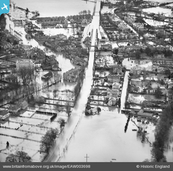
EAW003698 ENGLAND (1947). Flooding around Datchet Railway Station and The Green, Datchet, 1947
© Copyright OpenStreetMap contributors and licensed by the OpenStreetMap Foundation. 2026. Cartography is licensed as CC BY-SA.
Nearby Images (2)
EAW003698

EAW003701

Details
| Title | [EAW003698] Flooding around Datchet Railway Station and The Green, Datchet, 1947 |
| Reference | EAW003698 |
| Date | 18-March-1947 |
| Link | |
| Place name | DATCHET |
| Parish | DATCHET |
| District | |
| Country | ENGLAND |
| Easting / Northing | 498561, 177123 |
| Longitude / Latitude | -0.58040234533126, 51.483975722999 |
| National Grid Reference | SU986771 |
