
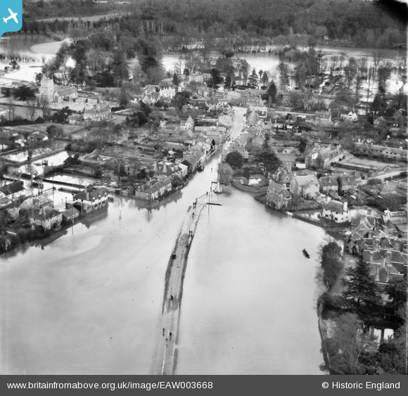
EAW003668 ENGLAND (1947). Flooding at Cookham Moor, Cookham, 1947
© Copyright OpenStreetMap contributors and licensed by the OpenStreetMap Foundation. 2025. Cartography is licensed as CC BY-SA.
Nearby Images (5)
EAW003668

EAW003670

EAW003669

EAW003829

EAW038165

Details
| Title | [EAW003668] Flooding at Cookham Moor, Cookham, 1947 |
| Reference | EAW003668 |
| Date | March-1947 |
| Link | |
| Place name | COOKHAM |
| Parish | COOKHAM |
| District | |
| Country | ENGLAND |
| Easting / Northing | 489469, 185331 |
| Longitude / Latitude | -0.70923434014456, 51.559279020666 |
| National Grid Reference | SU895853 |
Pins
Robert Tims |
Friday 13th of September 2013 04:07:45 PM |