
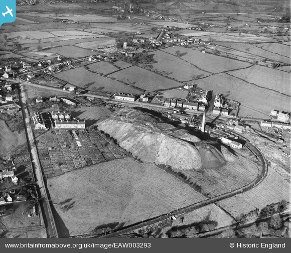
EAW003293 ENGLAND (1946). New Selston Colliery and environs, Selston, 1946
© Copyright OpenStreetMap contributors and licensed by the OpenStreetMap Foundation. 2026. Cartography is licensed as CC BY-SA.
Nearby Images (18)
EAW003293

EAW003288

EAW003295

EAW002810

EAW003291

EAW002807

EAW003297

EAW003287

EAW003292

EAW003294

EAW003290

EAW003289

EAW003296

EAW003298

EAW003299

EAW002809

EAW002811

EAW002808

Details
| Title | [EAW003293] New Selston Colliery and environs, Selston, 1946 |
| Reference | EAW003293 |
| Date | 4-November-1946 |
| Link | |
| Place name | SELSTON |
| Parish | SELSTON |
| District | |
| Country | ENGLAND |
| Easting / Northing | 445704, 352842 |
| Longitude / Latitude | -1.3177899158843, 53.070556154411 |
| National Grid Reference | SK457528 |
Pins
Be the first to add a comment to this image!