
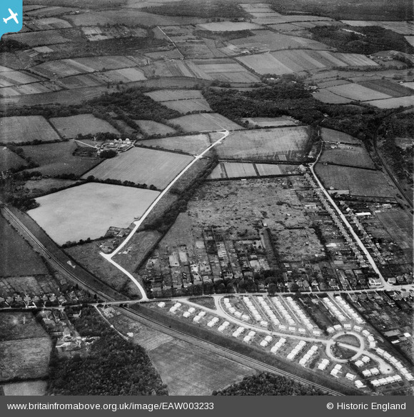
EAW003233 ENGLAND (1946). Hill Park and construction of prefabricated housing around Stow Crescent, Fareham, 1946
© Copyright OpenStreetMap contributors and licensed by the OpenStreetMap Foundation. 2026. Cartography is licensed as CC BY-SA.
Nearby Images (3)
EAW003233

EAW003237

EAW003235

Details
| Title | [EAW003233] Hill Park and construction of prefabricated housing around Stow Crescent, Fareham, 1946 |
| Reference | EAW003233 |
| Date | 25-October-1946 |
| Link | |
| Place name | FAREHAM |
| Parish | |
| District | |
| Country | ENGLAND |
| Easting / Northing | 455356, 107152 |
| Longitude / Latitude | -1.2133843065238, 50.860667482466 |
| National Grid Reference | SU554072 |
Pins

Josharpr |
Friday 9th of April 2021 10:14:00 PM | |
|
MikePilot&Navigator |
Sunday 21st of September 2014 10:12:11 PM | |
|
MikePilot&Navigator |
Sunday 21st of September 2014 10:10:57 PM | |
|
Mykiemike |
Tuesday 27th of August 2013 08:27:56 PM | |
|
Mykiemike |
Tuesday 27th of August 2013 08:27:17 PM | |
|
Mykiemike |
Tuesday 27th of August 2013 08:26:03 PM |