
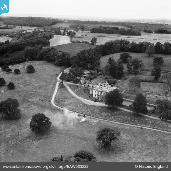
EAW003222 ENGLAND (1946). Kirkham Hall, Kirkham, from the south-west, 1946
© Copyright OpenStreetMap contributors and licensed by the OpenStreetMap Foundation. 2026. Cartography is licensed as CC BY-SA.
Nearby Images (17)
EAW003222

EAW003225

EPW017212

EAW003219

EPW017214

EAW003223

EPW017259

EAW003228

EAW003220

EAW003221

EAW003224

EAW003226

EAW003227

EAW003229

EPW017209

EAW003230

EAW003231

Details
| Title | [EAW003222] Kirkham Hall, Kirkham, from the south-west, 1946 |
| Reference | EAW003222 |
| Date | 18-October-1946 |
| Link | |
| Place name | KIRKHAM |
| Parish | WESTOW |
| District | |
| Country | ENGLAND |
| Easting / Northing | 473583, 465999 |
| Longitude / Latitude | -0.87503532459795, 54.084459380881 |
| National Grid Reference | SE736660 |
Pins
Be the first to add a comment to this image!