
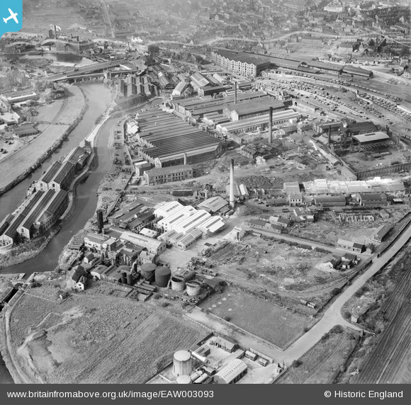
EAW003093 ENGLAND (1946). The Brotherton and Co Ammonia Works and the surrounding industrial area, Wakefield, 1946
© Copyright OpenStreetMap contributors and licensed by the OpenStreetMap Foundation. 2026. Cartography is licensed as CC BY-SA.
Nearby Images (16)
EAW003093

EAW003094

EAW003095

EAW003096

EAW003091

EAW003090

EPW032579

EAW002604

EPW032574

EAW002601

EAW003092

EAW002600

EPW032576

EAW002605

EAW003097

EAW002602

Details
| Title | [EAW003093] The Brotherton and Co Ammonia Works and the surrounding industrial area, Wakefield, 1946 |
| Reference | EAW003093 |
| Date | 11-October-1946 |
| Link | |
| Place name | WAKEFIELD |
| Parish | |
| District | |
| Country | ENGLAND |
| Easting / Northing | 434257, 420056 |
| Longitude / Latitude | -1.4813587920577, 53.675619075362 |
| National Grid Reference | SE343201 |
Pins

redmist |
Monday 9th of May 2022 08:07:29 PM |