
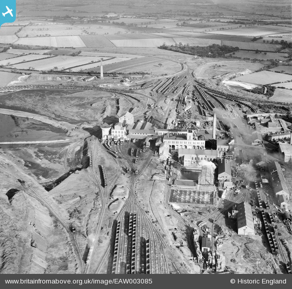
EAW003085 ENGLAND (1946). Bentley Colliery, Bentley, 1946
© Copyright OpenStreetMap contributors and licensed by the OpenStreetMap Foundation. 2026. Cartography is licensed as CC BY-SA.
Nearby Images (7)
EAW003085

EAW003083

EAW003087

EAW003084

EAW003088

EAW003086

EAW003089

Details
| Title | [EAW003085] Bentley Colliery, Bentley, 1946 |
| Reference | EAW003085 |
| Date | 8-October-1946 |
| Link | |
| Place name | BENTLEY |
| Parish | |
| District | |
| Country | ENGLAND |
| Easting / Northing | 456956, 407532 |
| Longitude / Latitude | -1.1400276546783, 53.561068996323 |
| National Grid Reference | SE570075 |
Pins

John Wass |
Tuesday 15th of July 2014 03:11:28 PM |