
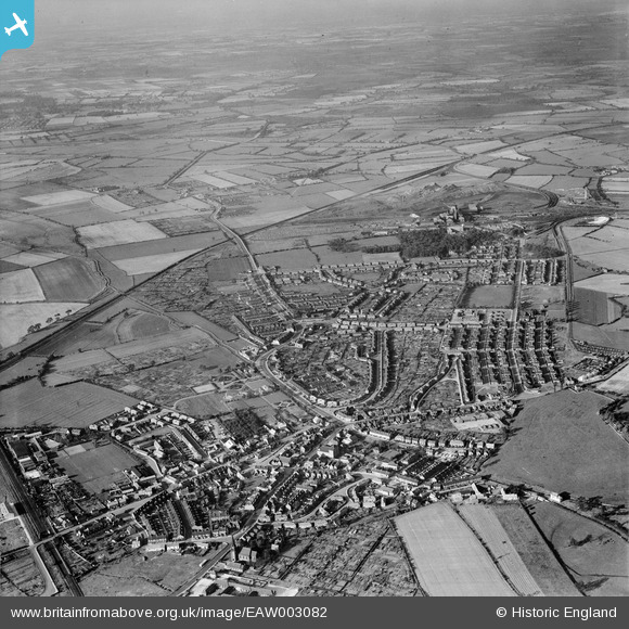
EAW003082 ENGLAND (1946). Bentley New Village, Bentley, from the south, 1946
© Copyright OpenStreetMap contributors and licensed by the OpenStreetMap Foundation. 2026. Cartography is licensed as CC BY-SA.
Nearby Images (3)
EAW003082

EPW012856

EPW042045

Details
| Title | [EAW003082] Bentley New Village, Bentley, from the south, 1946 |
| Reference | EAW003082 |
| Date | 8-October-1946 |
| Link | |
| Place name | BENTLEY |
| Parish | |
| District | |
| Country | ENGLAND |
| Easting / Northing | 456667, 405923 |
| Longitude / Latitude | -1.1446824175502, 53.546637985633 |
| National Grid Reference | SE567059 |
Pins

Matt Aldred edob.mattaldred.com |
Sunday 8th of February 2026 12:22:39 PM | |
|
Matt Aldred edob.mattaldred.com |
Friday 6th of February 2026 02:10:06 PM | |

redmist |
Tuesday 19th of April 2022 10:53:06 PM | |

Sparky |
Friday 15th of September 2017 06:13:38 PM | |
|
Sparky |
Friday 15th of September 2017 06:13:00 PM | |
|
John Wass |
Tuesday 15th of July 2014 03:09:08 PM | |
They are in the sidings at Bullcroft Junction, which gave access to the branch to Bentley Colliery |
Dormergreen |
Tuesday 1st of March 2016 11:59:33 AM |