
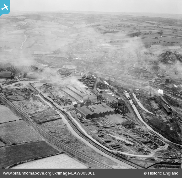
EAW003061 ENGLAND (1946). The Staveley Iron Works and environs, Staveley, from the south-east, 1946
© Copyright OpenStreetMap contributors and licensed by the OpenStreetMap Foundation. 2026. Cartography is licensed as CC BY-SA.
Nearby Images (10)
EAW003061

EAW043846

EPW057343

EPW041677

EAW043847

EAW044349

EPW057338

EPW057354

EAW003060

EPW041673

Details
| Title | [EAW003061] The Staveley Iron Works and environs, Staveley, from the south-east, 1946 |
| Reference | EAW003061 |
| Date | 8-October-1946 |
| Link | |
| Place name | STAVELEY |
| Parish | STAVELEY |
| District | |
| Country | ENGLAND |
| Easting / Northing | 442012, 374580 |
| Longitude / Latitude | -1.370040096859, 53.266271337471 |
| National Grid Reference | SK420746 |
