
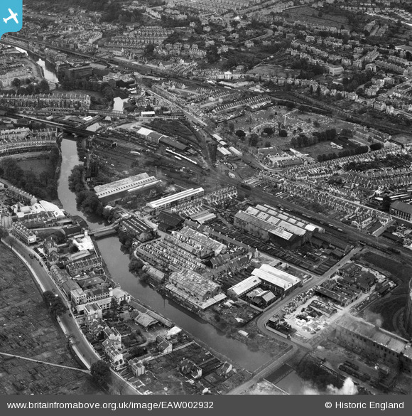
EAW002932 ENGLAND (1946). Industry at Bath Riverside including the Victoria Works and Avonbank Works, Bath, 1946
© Copyright OpenStreetMap contributors and licensed by the OpenStreetMap Foundation. 2026. Cartography is licensed as CC BY-SA.
Nearby Images (10)
EAW002932

EAW002931

EAW002935

EAW002938

EAW002946

EAW002937

EAW002933

EAW002934

EAW002936

EAW002947

Details
| Title | [EAW002932] Industry at Bath Riverside including the Victoria Works and Avonbank Works, Bath, 1946 |
| Reference | EAW002932 |
| Date | 2-October-1946 |
| Link | |
| Place name | BATH |
| Parish | |
| District | |
| Country | ENGLAND |
| Easting / Northing | 374068, 164877 |
| Longitude / Latitude | -2.3726650186302, 51.381851606615 |
| National Grid Reference | ST741649 |
Pins

Sparky |
Saturday 16th of September 2017 10:01:39 AM | |

Class31 |
Thursday 24th of July 2014 03:40:10 PM | |
|
Class31 |
Tuesday 22nd of July 2014 11:01:25 PM | |
|
Class31 |
Monday 11th of November 2013 09:48:14 AM | |
|
Class31 |
Monday 11th of November 2013 09:43:50 AM | |
|
Class31 |
Monday 11th of November 2013 09:41:54 AM |
