
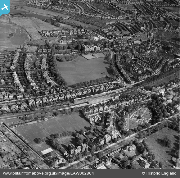
EAW002864 ENGLAND (1946). Central Station, Radnor Park and the surrounding residential area, Folkestone, 1946
© Copyright OpenStreetMap contributors and licensed by the OpenStreetMap Foundation. 2026. Cartography is licensed as CC BY-SA.
Nearby Images (6)
EAW002864

EAW002865

EAW002866

EAW002368

EAW002369

EAW002367

Details
| Title | [EAW002864] Central Station, Radnor Park and the surrounding residential area, Folkestone, 1946 |
| Reference | EAW002864 |
| Date | 1-October-1946 |
| Link | |
| Place name | FOLKESTONE |
| Parish | FOLKESTONE |
| District | |
| Country | ENGLAND |
| Easting / Northing | 622048, 136364 |
| Longitude / Latitude | 1.1707521552733, 51.083019246712 |
| National Grid Reference | TR220364 |
Pins

Jumper_downunder |
Thursday 13th of June 2019 03:45:10 AM | |

Sparky |
Saturday 16th of September 2017 12:56:25 PM | |
|
Sparky |
Saturday 16th of September 2017 12:55:12 PM | |
|
Sparky |
Saturday 16th of September 2017 12:54:03 PM |