
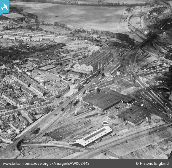
EAW002443 ENGLAND (1946). Stafford Road Engineering (Railway) Works and environs, Wolverhampton, 1946
© Copyright OpenStreetMap contributors and licensed by the OpenStreetMap Foundation. 2026. Cartography is licensed as CC BY-SA.
Nearby Images (12)
EAW002443
 Works and environs, Wolverhampton, 1946")
EAW002444
 Works and environs, Wolverhampton, 1946")
EAW002440
 Works, Dunstall Park Racecourse and environs, Wolverhampton, 1946")
EAW002439
 Works and environs, Wolverhampton, 1946")
EAW002446
 Works, Wolverhampton, 1946")
EAW002451
 Works, Wolverhampton, 1946")
EAW002445
 Works and environs, Wolverhampton, 1946")
EAW002447
 Works and environs, Wolverhampton, 1946")
EAW002450
 Works, Dunstall Park Racecourse and environs, Wolverhampton, from the south-east, 1946")
EAW002449
 Works, Dunstall Park Racecourse and environs, Wolverhampton, from the south-east, 1946")
EAW002441
 Works, Wolverhampton, 1946")
EAW002442
 Works, Dunstall Park Racecourse and environs, Wolverhampton, from the south-east, 1946")
Details
| Title | [EAW002443] Stafford Road Engineering (Railway) Works and environs, Wolverhampton, 1946 |
| Reference | EAW002443 |
| Date | 6-September-1946 |
| Link | |
| Place name | WOLVERHAMPTON |
| Parish | |
| District | |
| Country | ENGLAND |
| Easting / Northing | 391288, 300173 |
| Longitude / Latitude | -2.1286396298936, 52.598922848178 |
| National Grid Reference | SJ913002 |
