
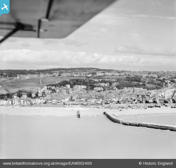
EAW002400 ENGLAND (1946). The seafront and West Hill, Hastings, from the south, 1946
© Copyright OpenStreetMap contributors and licensed by the OpenStreetMap Foundation. 2026. Cartography is licensed as CC BY-SA.
Nearby Images (11)
EAW002400

EPW026196

EPW039362

EPW018304

EPW026195

EAW022978

EPW000675

EPW026187

EAW002401

EPW042837

EPW039368

Details
| Title | [EAW002400] The seafront and West Hill, Hastings, from the south, 1946 |
| Reference | EAW002400 |
| Date | 16-September-1946 |
| Link | |
| Place name | HASTINGS |
| Parish | |
| District | |
| Country | ENGLAND |
| Easting / Northing | 582487, 109599 |
| Longitude / Latitude | 0.59309531028082, 50.856512850141 |
| National Grid Reference | TQ825096 |
