
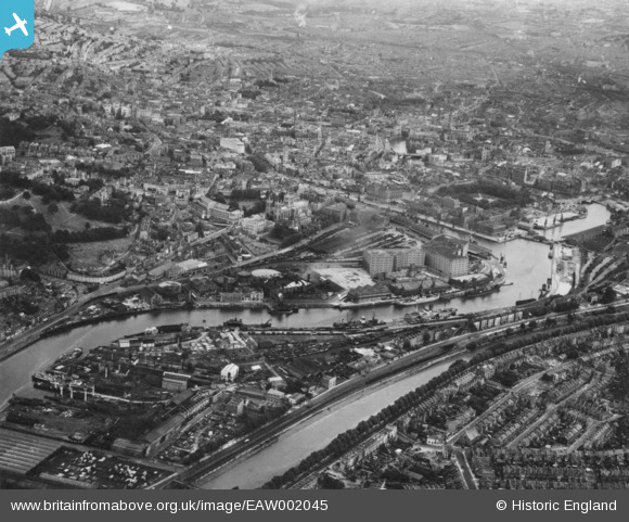
EAW002045 ENGLAND (1946). The Floating Harbour and the city centre, Bristol, 1946. This image has been produced from a print.
© Copyright OpenStreetMap contributors and licensed by the OpenStreetMap Foundation. 2026. Cartography is licensed as CC BY-SA.
Nearby Images (34)
EAW002045

EPW033502

EAW002262

EAW002048

EPW005442

EPW008828

EPW005440

EPW005462

EPW005441

EPW005472

EPW005446

EPW033504

EPW005445

EPW005444

EPW005473

EAW002049

EPW005443

EAW052874

EAW000700

EAW052884

EAW033314

EPW041479

EPW012017

EAW000705

EPR000106

EPW005448

EPW005450

EPW005452

EPW005451

EPW005447

EPW033506

EPW005449

EAW000703

EAW002258

Details
| Title | [EAW002045] The Floating Harbour and the city centre, Bristol, 1946. This image has been produced from a print. |
| Reference | EAW002045 |
| Date | 31-July-1946 |
| Link | |
| Place name | BRISTOL |
| Parish | |
| District | |
| Country | ENGLAND |
| Easting / Northing | 358258, 172540 |
| Longitude / Latitude | -2.6007599551655, 51.449815659802 |
| National Grid Reference | ST583725 |

