
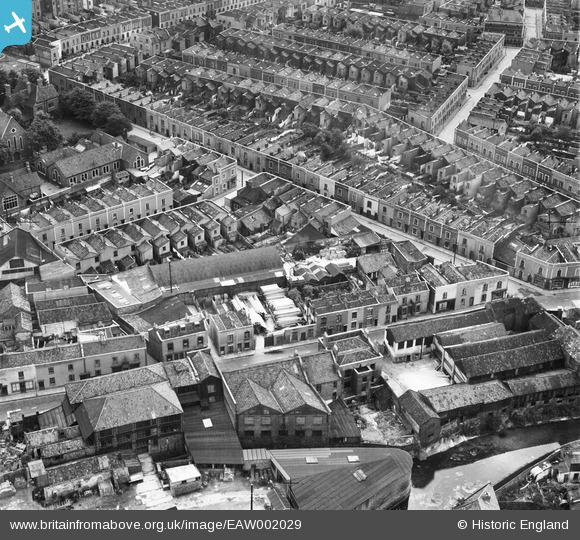
EAW002029 ENGLAND (1946). Pennywell Road and Bean Street, Bristol, 1946
© Copyright OpenStreetMap contributors and licensed by the OpenStreetMap Foundation. 2026. Cartography is licensed as CC BY-SA.
Nearby Images (10)
EAW002029

EAW002030

EAW002032

EAW002028

EAW002031

EAW002023

EAW002026

EAW002024

EAW002027

EAW002025

Details
| Title | [EAW002029] Pennywell Road and Bean Street, Bristol, 1946 |
| Reference | EAW002029 |
| Date | 29-July-1946 |
| Link | |
| Place name | BRISTOL |
| Parish | |
| District | |
| Country | ENGLAND |
| Easting / Northing | 360195, 174176 |
| Longitude / Latitude | -2.5730679571236, 51.46466629092 |
| National Grid Reference | ST602742 |
Pins

Class31 |
Monday 2nd of September 2013 02:17:33 PM | |
|
Class31 |
Monday 2nd of September 2013 02:16:12 PM | |
|
Class31 |
Monday 2nd of September 2013 02:14:50 PM | |
|
Class31 |
Monday 2nd of September 2013 02:12:52 PM | |
|
Class31 |
Monday 2nd of September 2013 02:12:24 PM | |
|
Class31 |
Monday 2nd of September 2013 02:11:58 PM | |
Can you please tell me if bean st and Penny well road run on to each other in the 1881 census both my family where on the same page one Bean st and the other Pennywell road. I know that the family in Pennywell road had a shop thank you |

patsy |
Monday 5th of May 2014 01:28:33 PM |
In the photo Bean St runs diagonally from top left to join Pennywell Rd. At the top end of Bean Street is St Simons Primary school which I attended until the early sixties when the area was cleared for redevelopment and the M32. I think that St Simon's Church (out of picture)still stands |
Pennydreadfull |
Sunday 22nd of June 2014 02:50:49 PM |