
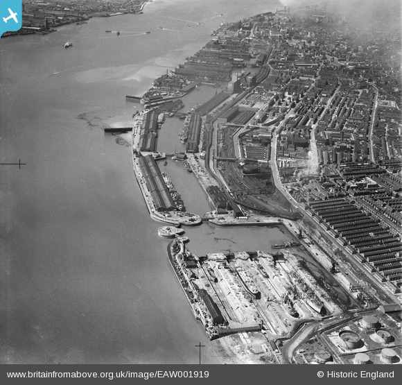
EAW001919 ENGLAND (1946). The Herculaneum Graving Docks, the Harrington Dock and the surrounding area alongside the River Mersey, Liverpool, 1946
© Copyright OpenStreetMap contributors and licensed by the OpenStreetMap Foundation. 2026. Cartography is licensed as CC BY-SA.
Nearby Images (2)
EAW001919

EPW018903

Details
| Title | [EAW001919] The Herculaneum Graving Docks, the Harrington Dock and the surrounding area alongside the River Mersey, Liverpool, 1946 |
| Reference | EAW001919 |
| Date | 12-July-1946 |
| Link | |
| Place name | LIVERPOOL |
| Parish | |
| District | |
| Country | ENGLAND |
| Easting / Northing | 335247, 387556 |
| Longitude / Latitude | -2.9735628217277, 53.380616466579 |
| National Grid Reference | SJ352876 |
Pins

Pcrail |
Monday 16th of March 2026 05:10:38 PM | |
|
Pcrail |
Monday 16th of March 2026 05:10:23 PM | |
|
Pcrail |
Monday 16th of March 2026 05:10:10 PM | |
|
Pcrail |
Monday 16th of March 2026 05:09:55 PM | |
|
Pcrail |
Monday 16th of March 2026 05:09:19 PM | |
|
Pcrail |
Monday 16th of March 2026 05:08:57 PM | |
|
Pcrail |
Monday 16th of March 2026 05:08:41 PM | |
|
Skier |
Wednesday 29th of March 2023 08:16:15 PM | |
|
Skier |
Wednesday 29th of March 2023 08:12:54 PM | |
|
austin |
Saturday 19th of February 2022 09:21:36 PM | |
|
austin |
Saturday 19th of February 2022 09:12:41 PM | |
|
austin |
Saturday 19th of February 2022 08:58:34 PM | |
|
austin |
Saturday 19th of February 2022 08:56:53 PM | |
|
austin |
Saturday 19th of February 2022 08:53:58 PM | |
|
austin |
Wednesday 24th of February 2021 04:07:28 PM | |
|
Peter |
Tuesday 11th of October 2016 12:19:21 PM | |
|
Strider |
Wednesday 13th of August 2014 07:54:47 PM |