
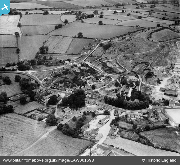
EAW001698 ENGLAND (1946). The village, Breedon on the Hill, 1946
© Copyright OpenStreetMap contributors and licensed by the OpenStreetMap Foundation. 2025. Cartography is licensed as CC BY-SA.
Nearby Images (16)
EAW001698

EAW001697

EAW001701

EAW001700

EAW001699

EAW000935

EPW062141

EPW062142

EAW000929

EAW000941

EAW000942

EAW000940

EAW000943

EPW062140

EPW062139

EPW062143

Details
| Title | [EAW001698] The village, Breedon on the Hill, 1946 |
| Reference | EAW001698 |
| Date | 12-July-1946 |
| Link | |
| Place name | BREEDON ON THE HILL |
| Parish | BREEDON ON THE HILL |
| District | |
| Country | ENGLAND |
| Easting / Northing | 440490, 322923 |
| Longitude / Latitude | -1.399348562322, 52.80201053755 |
| National Grid Reference | SK405229 |
Pins
 Matt Aldred edob.mattaldred.com |
Tuesday 22nd of February 2022 08:29:56 PM |