
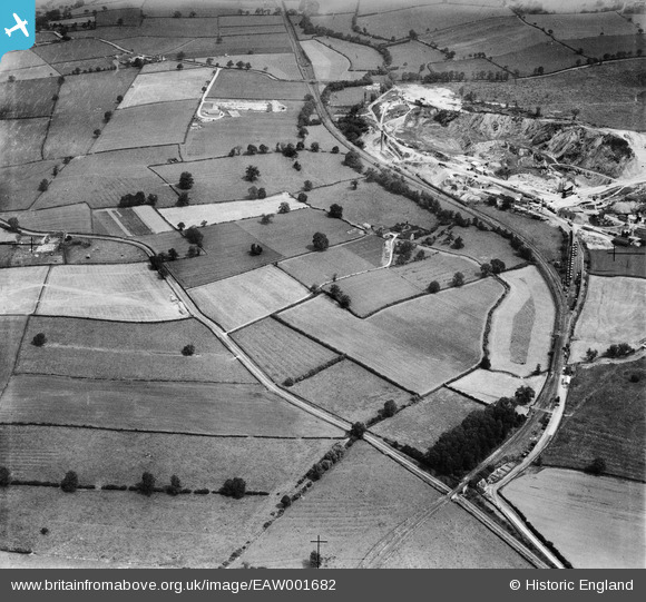
EAW001682 ENGLAND (1946). Worthington Corn Mill and Cloud Hill Quarry, Worthington, 1946
© Copyright OpenStreetMap contributors and licensed by the OpenStreetMap Foundation. 2026. Cartography is licensed as CC BY-SA.
Nearby Images (3)
EAW001682

EAW001681

EAW001680

Details
| Title | [EAW001682] Worthington Corn Mill and Cloud Hill Quarry, Worthington, 1946 |
| Reference | EAW001682 |
| Date | 12-July-1946 |
| Link | |
| Place name | WORTHINGTON |
| Parish | WORTHINGTON |
| District | |
| Country | ENGLAND |
| Easting / Northing | 440689, 321323 |
| Longitude / Latitude | -1.3965957492909, 52.787611513666 |
| National Grid Reference | SK407213 |
Pins

Peter Kazmierczak |
Monday 27th of October 2014 10:59:24 PM |