
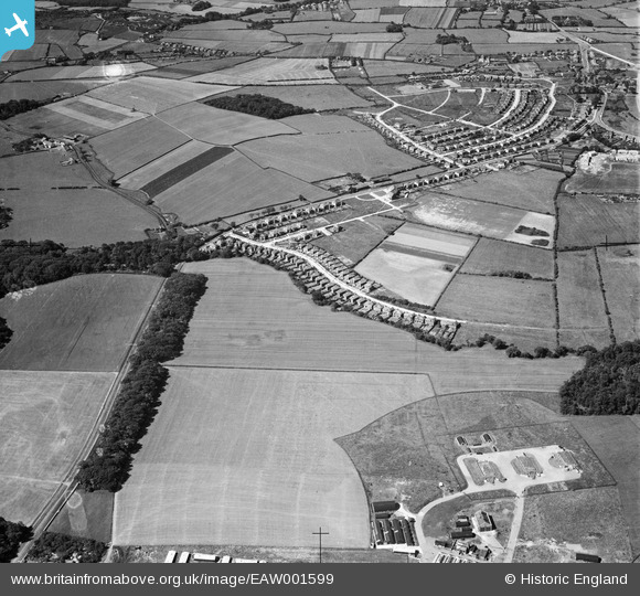
EAW001599 ENGLAND (1946). Brookdale Avenue and the edge of Upton Army Camp, Greasby, 1946
© Copyright OpenStreetMap contributors and licensed by the OpenStreetMap Foundation. 2026. Cartography is licensed as CC BY-SA.
Details
| Title | [EAW001599] Brookdale Avenue and the edge of Upton Army Camp, Greasby, 1946 |
| Reference | EAW001599 |
| Date | 11-July-1946 |
| Link | |
| Place name | GREASBY |
| Parish | |
| District | |
| Country | ENGLAND |
| Easting / Northing | 326473, 387121 |
| Longitude / Latitude | -3.105353534928, 53.375558210709 |
| National Grid Reference | SJ265871 |
Pins

JUNGLEJIM |
Friday 28th of February 2025 09:26:02 AM | |
|
JUNGLEJIM |
Friday 28th of February 2025 08:48:26 AM | |
|
nemo20000 |
Sunday 5th of June 2022 04:33:58 PM | |
|
nemo20000 |
Sunday 5th of June 2022 04:31:47 PM | |

Sparky |
Friday 22nd of September 2017 06:29:41 PM | |
|
Sparky |
Friday 22nd of September 2017 06:29:00 PM | |
|
Roger Reid |
Tuesday 18th of February 2014 04:40:58 AM | |
|
Roger Reid |
Tuesday 18th of February 2014 04:40:01 AM |