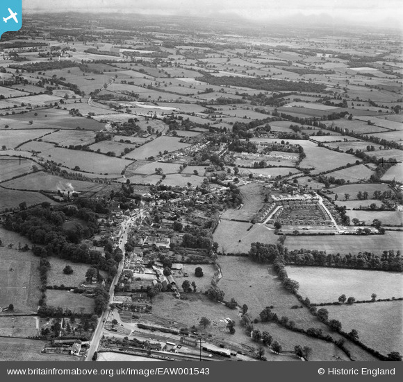
EAW001543 ENGLAND (1946). The town, Chipping Ongar, from the north, 1946
© Copyright OpenStreetMap contributors and licensed by the OpenStreetMap Foundation. 2025. Cartography is licensed as CC BY-SA.
Nearby Images (4)
EAW001543

EAW037034

EAW001542

EAW037033

Details
| Title | [EAW001543] The town, Chipping Ongar, from the north, 1946 |
| Reference | EAW001543 |
| Date | 5-July-1946 |
| Link | |
| Place name | CHIPPING ONGAR |
| Parish | ONGAR |
| District | |
| Country | ENGLAND |
| Easting / Northing | 555087, 203118 |
| Longitude / Latitude | 0.24469857634866, 51.704878758372 |
| National Grid Reference | TL551031 |
Pins

John W |
Sunday 31st of July 2016 05:36:07 PM | |

Class31 |
Monday 26th of May 2014 08:49:09 PM | |
|
MB |
Saturday 14th of September 2013 01:13:53 PM | |
|
MB |
Saturday 14th of September 2013 01:13:02 PM | |
|
MB |
Saturday 14th of September 2013 01:11:46 PM | |
|
MB |
Saturday 14th of September 2013 01:09:56 PM | |
|
MB |
Saturday 14th of September 2013 01:09:32 PM | |
|
MB |
Saturday 14th of September 2013 01:08:49 PM | |
|
MB |
Saturday 14th of September 2013 01:08:23 PM | |
|
MB |
Saturday 14th of September 2013 01:07:17 PM | |
|
MB |
Saturday 14th of September 2013 01:05:44 PM | |
|
MB |
Saturday 14th of September 2013 01:00:29 PM |