
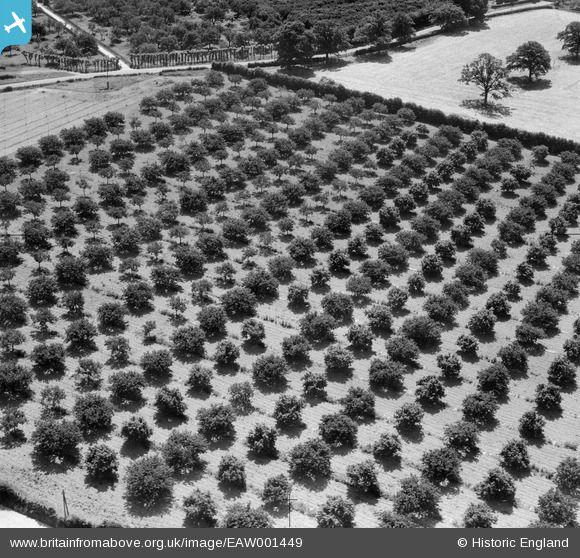
EAW001449 ENGLAND (1946). An orchard on the south of Churn Lane, Horsmonden, 1946
© Copyright OpenStreetMap contributors and licensed by the OpenStreetMap Foundation. 2026. Cartography is licensed as CC BY-SA.
Nearby Images (2)
EAW001449

EAW001450

Details
| Title | [EAW001449] An orchard on the south of Churn Lane, Horsmonden, 1946 |
| Reference | EAW001449 |
| Date | 3-July-1946 |
| Link | |
| Place name | HORSMONDEN |
| Parish | HORSMONDEN |
| District | |
| Country | ENGLAND |
| Easting / Northing | 570860, 142854 |
| Longitude / Latitude | 0.44370271219697, 51.158865802503 |
| National Grid Reference | TQ709429 |
Pins

Class31 |
Wednesday 18th of September 2013 04:32:30 PM | |
|
Class31 |
Wednesday 18th of September 2013 04:31:33 PM | |
|
Class31 |
Wednesday 18th of September 2013 04:30:43 PM | |
|
Class31 |
Wednesday 18th of September 2013 04:30:15 PM |
User Comment Contributions
It's tricky but it's right. Thanks for spending what must have been a lot of time on these... Yours, Katy Britain from Above Cataloguing Team Leader |
Katy Whitaker |
Friday 1st of November 2013 01:27:39 PM |
View looking south east. |
Class31 |
Wednesday 18th of September 2013 04:33:27 PM |
EAW001450 covers the same area |
Class31 |
Friday 30th of August 2013 12:02:33 PM |