
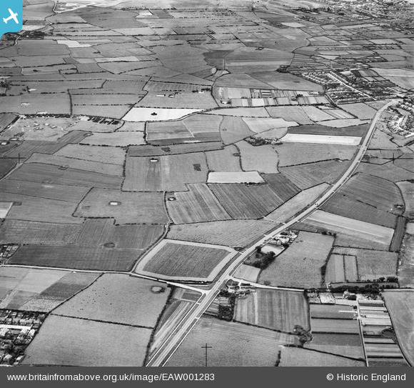
EAW001283 ENGLAND (1946). Birkenhead Road and the surrounding countryside, Hoylake, 1946
© Copyright OpenStreetMap contributors and licensed by the OpenStreetMap Foundation. 2026. Cartography is licensed as CC BY-SA.
Details
| Title | [EAW001283] Birkenhead Road and the surrounding countryside, Hoylake, 1946 |
| Reference | EAW001283 |
| Date | 24-June-1946 |
| Link | |
| Place name | HOYLAKE |
| Parish | |
| District | |
| Country | ENGLAND |
| Easting / Northing | 324510, 389183 |
| Longitude / Latitude | -3.1353506333025, 53.393814345464 |
| National Grid Reference | SJ245892 |
Pins

JethroBodineJr |
Thursday 30th of September 2021 06:03:19 PM | |
|
JethroBodineJr |
Thursday 30th of September 2021 06:02:25 PM | |
|
JethroBodineJr |
Thursday 30th of September 2021 05:56:52 PM | |
|
JethroBodineJr |
Thursday 30th of September 2021 05:55:19 PM | |
|
JethroBodineJr |
Thursday 30th of September 2021 05:54:39 PM | |
|
JUNGLEJIM |
Tuesday 19th of January 2021 02:15:48 PM | |
|
JUNGLEJIM |
Tuesday 19th of January 2021 02:14:40 PM | |
|
redmist |
Monday 7th of October 2019 10:47:38 AM | |

Sparky |
Friday 28th of July 2017 09:47:24 PM | |
|
Al |
Monday 6th of January 2014 03:33:05 PM | |
|
cptpies |
Monday 6th of January 2014 11:03:44 AM | |
I thought I'd replied to this but the placemark is off. The battery is at 53°23'21.17"N 3° 8'20.30"W some hut bases are visible on the latest GE imagery |
Al |
Monday 6th of January 2014 03:31:07 PM |
User Comment Contributions
WWII HAA Battery G/H 29. |
cptpies |
Monday 6th of January 2014 11:04:10 AM |