
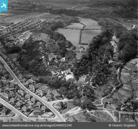
EAW001190 ENGLAND (1946). Wren's Nest Hill, Dudley, 1946
© Copyright OpenStreetMap contributors and licensed by the OpenStreetMap Foundation. 2026. Cartography is licensed as CC BY-SA.
Nearby Images (4)
EAW001190

EAW001189

EAW001191

EAW001188

Details
| Title | [EAW001190] Wren's Nest Hill, Dudley, 1946 |
| Reference | EAW001190 |
| Date | 21-June-1946 |
| Link | |
| Place name | DUDLEY |
| Parish | |
| District | |
| Country | ENGLAND |
| Easting / Northing | 393730, 291516 |
| Longitude / Latitude | -2.092417903722, 52.521122522938 |
| National Grid Reference | SO937915 |
Pins

Matt Aldred edob.mattaldred.com |
Tuesday 1st of November 2022 03:06:24 PM | |

DaveT |
Friday 11th of April 2014 05:47:15 AM | |
|
DaveT |
Tuesday 21st of January 2014 12:53:31 PM |