
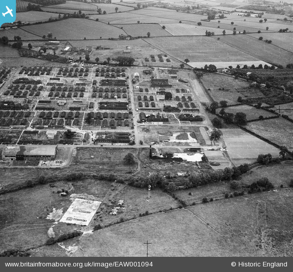
EAW001094 ENGLAND (1946). RAF Hereford (Credenhill), Credenhill, 1946
© Copyright OpenStreetMap contributors and licensed by the OpenStreetMap Foundation. 2026. Cartography is licensed as CC BY-SA.
Nearby Images (2)
EAW001094
, Credenhill, 1946")
EAW001095
, Credenhill, 1946")
Details
| Title | [EAW001094] RAF Hereford (Credenhill), Credenhill, 1946 |
| Reference | EAW001094 |
| Date | 16-June-1946 |
| Link | |
| Place name | CREDENHILL |
| Parish | CREDENHILL |
| District | |
| Country | ENGLAND |
| Easting / Northing | 345873, 243048 |
| Longitude / Latitude | -2.7899812284978, 52.082722409373 |
| National Grid Reference | SO459430 |
Pins

Dr. David Woods |
Friday 5th of February 2016 03:37:29 PM |
User Comment Contributions

RAF Hereford (Credenhill), Credenhill, 1946 |
Hollybush |
Saturday 24th of August 2013 11:09:55 AM |