
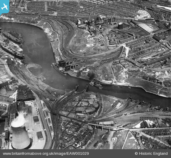
EAW001029 ENGLAND (1946). The River Wear, the Wearmouth Colliery and the surrounding industrial area, Sunderland, 1946
© Copyright OpenStreetMap contributors and licensed by the OpenStreetMap Foundation. 2026. Cartography is licensed as CC BY-SA.
Nearby Images (9)
EAW001029

EPW020541

EPW020543

EPW020545

EPW020540

EPW020547

EPW020542

EPW020551

EPW020553

Details
| Title | [EAW001029] The River Wear, the Wearmouth Colliery and the surrounding industrial area, Sunderland, 1946 |
| Reference | EAW001029 |
| Date | 6-June-1946 |
| Link | |
| Place name | SUNDERLAND |
| Parish | |
| District | |
| Country | ENGLAND |
| Easting / Northing | 439191, 557631 |
| Longitude / Latitude | -1.3886171345081, 54.911765411202 |
| National Grid Reference | NZ392576 |
Pins

BBCoaster |
Sunday 7th of January 2024 04:58:29 PM | |
|
avocet |
Saturday 11th of March 2017 04:46:50 AM | |
|
avocet |
Saturday 11th of March 2017 04:45:49 AM | |
|
avocet |
Saturday 11th of March 2017 04:44:55 AM | |
|
avocet |
Saturday 11th of March 2017 04:33:11 AM | |
|
avocet |
Saturday 11th of March 2017 04:33:07 AM | |
|
kevin n |
Tuesday 7th of January 2014 01:17:56 PM | |
|
kevin n |
Tuesday 7th of January 2014 01:15:11 PM |