
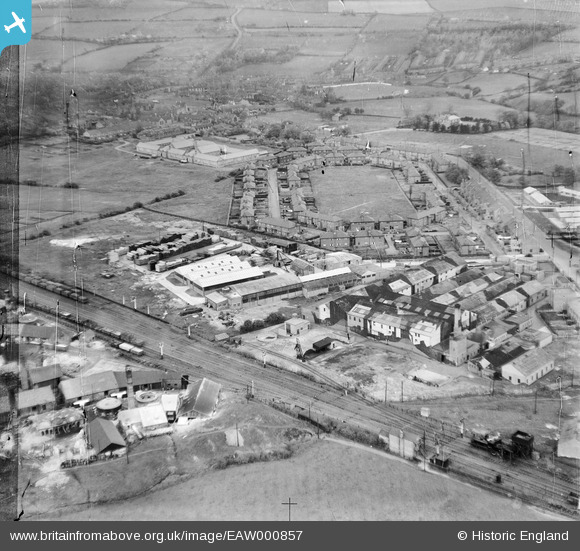
EAW000857 ENGLAND (1946). Durham Timber Co Timber Yard and South End Villas, Crook, 1946
© Copyright OpenStreetMap contributors and licensed by the OpenStreetMap Foundation. 2026. Cartography is licensed as CC BY-SA.
Nearby Images (29)
EAW000857

EAW016869

EAW016870

EAW000856

EAW016873

EAW016868

EAW000855

EPW060895

EAW016874

EAW016875

EAW016865

EPW060894

EAW000858A

EPW060893

EAW000858

EPW060897

EPW060890

EPW060892

EPW060891

EPW060896

EPW060887

EAW016876

EPW060888

EAW016872

EAW016866

EAW016867

EAW016871

EAW016864

EPW060889

Details
| Title | [EAW000857] Durham Timber Co Timber Yard and South End Villas, Crook, 1946 |
| Reference | EAW000857 |
| Date | 15-May-1946 |
| Link | |
| Place name | CROOK |
| Parish | |
| District | |
| Country | ENGLAND |
| Easting / Northing | 416165, 535014 |
| Longitude / Latitude | -1.7490808424705, 54.709773220067 |
| National Grid Reference | NZ162350 |

