
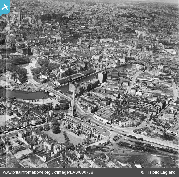
EAW000738 ENGLAND (1946). Redcliffe Bridge, the Church of St Mary Redcliff and the city, Bristol, from the south-east, 1946
© Copyright OpenStreetMap contributors and licensed by the OpenStreetMap Foundation. 2026. Cartography is licensed as CC BY-SA.
Nearby Images (14)
EAW000738

EPW005476

EAW000739

EPW008824

EAW000737

EPW008822

EPW008820

EPW008819

EPW008826A

EPW008825

EPW008821

EPW008823

EPW008826

EAW026795

Details
| Title | [EAW000738] Redcliffe Bridge, the Church of St Mary Redcliff and the city, Bristol, from the south-east, 1946 |
| Reference | EAW000738 |
| Date | 9-May-1946 |
| Link | |
| Place name | BRISTOL |
| Parish | |
| District | |
| Country | ENGLAND |
| Easting / Northing | 359060, 172407 |
| Longitude / Latitude | -2.5892026651205, 51.448678279824 |
| National Grid Reference | ST591724 |
Pins

Sparky |
Tuesday 26th of September 2017 08:04:58 AM | |

Class31 |
Thursday 12th of December 2013 09:35:48 PM | |

Chelsea61 |
Saturday 24th of August 2013 05:52:25 PM | |
|
Chelsea61 |
Saturday 24th of August 2013 05:51:49 PM | |
|
Chelsea61 |
Saturday 24th of August 2013 05:51:12 PM | |
|
Chelsea61 |
Saturday 24th of August 2013 05:50:43 PM | |
|
Chelsea61 |
Saturday 24th of August 2013 05:50:13 PM |