
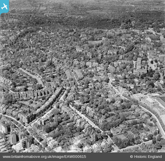
EAW000615 ENGLAND (1946). The residential area to the south of West Heath, Hampstead, 1946
© Copyright OpenStreetMap contributors and licensed by the OpenStreetMap Foundation. 2026. Cartography is licensed as CC BY-SA.
Nearby Images (4)
EAW000615

EAW014554

EPW000817

EPW000813

Details
| Title | [EAW000615] The residential area to the south of West Heath, Hampstead, 1946 |
| Reference | EAW000615 |
| Date | 10-May-1946 |
| Link | |
| Place name | HAMPSTEAD |
| Parish | |
| District | |
| Country | ENGLAND |
| Easting / Northing | 525996, 185543 |
| Longitude / Latitude | -0.18242881775544, 51.554207173723 |
| National Grid Reference | TQ260855 |
Pins
Be the first to add a comment to this image!