
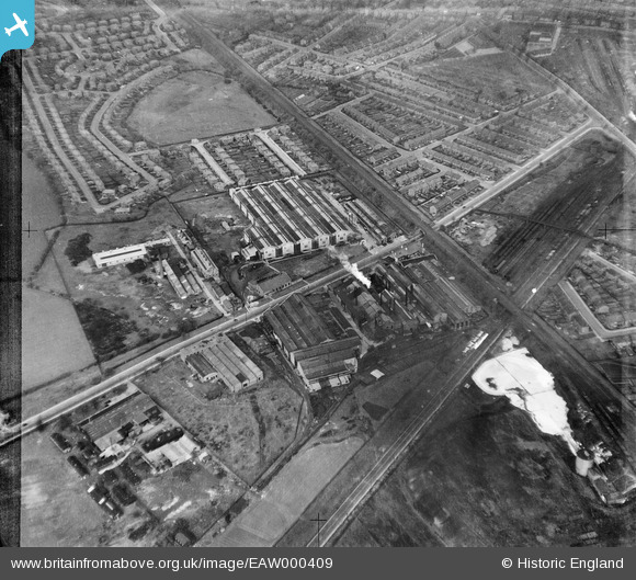
EAW000409 ENGLAND (1946). The Oil Well Engineering Works, Cheadle Heath, 1946. This image has been produced from a damaged negative.
© Copyright OpenStreetMap contributors and licensed by the OpenStreetMap Foundation. 2026. Cartography is licensed as CC BY-SA.
Nearby Images (30)
EAW000409

EAW039600

EPW049689

EAW039598

EAW000405

EAW000403

EAW039601

EAW039599

EAW000400

EAW039596

EPW049692

EAW000401

EAW039597

EPW016700

EAW052660

EAW000402

EPW049690

EAW000407

EPW049693

EAW000404

EPW049691

EAW052657

EAW052656

EAW052661

EAW000408

EAW052659

EAW052654

EAW052658

EAW000406

EAW052655

Details
| Title | [EAW000409] The Oil Well Engineering Works, Cheadle Heath, 1946. This image has been produced from a damaged negative. |
| Reference | EAW000409 |
| Date | 17-April-1946 |
| Link | |
| Place name | CHEADLE HEATH |
| Parish | |
| District | |
| Country | ENGLAND |
| Easting / Northing | 387728, 388795 |
| Longitude / Latitude | -2.1845720548428, 53.395581497974 |
| National Grid Reference | SJ877888 |
