
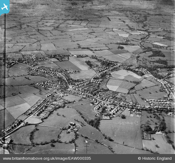
EAW000335 ENGLAND (1946). Housing at Wells Green and surrounding countryside, Wistaston, 1946
© Copyright OpenStreetMap contributors and licensed by the OpenStreetMap Foundation. 2026. Cartography is licensed as CC BY-SA.
Nearby Images (3)
EAW000335

EAW000332

EAW000341

Details
| Title | [EAW000335] Housing at Wells Green and surrounding countryside, Wistaston, 1946 |
| Reference | EAW000335 |
| Date | 19-April-1946 |
| Link | |
| Place name | WISTASTON |
| Parish | WISTASTON |
| District | |
| Country | ENGLAND |
| Easting / Northing | 368659, 353740 |
| Longitude / Latitude | -2.4679149484114, 53.079664895211 |
| National Grid Reference | SJ687537 |
Pins

i.griffin@comcast.net |
Sunday 26th of October 2014 01:22:14 AM |