
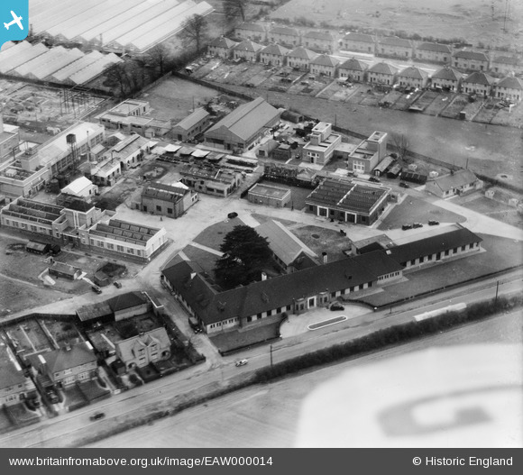
EAW000014 ENGLAND (1946). Buildings on the south side of Chertsey Road, Ashford Common, 1946
© Copyright OpenStreetMap contributors and licensed by the OpenStreetMap Foundation. 2026. Cartography is licensed as CC BY-SA.
Nearby Images (30)
EAW000014

EAW017551
 Research Station, Ashford Common, 1948. This image has been produced from a print.")
EAW017559
 Research Station, Ashford Common, 1948. This image has been produced from a damaged negative.")
EAW000013

EPW056783
 Research Laboratory and the Meadhurst Park Nursery, Ashford Common, 1938")
EPW056779
 Research Laboratory and surroundings, Ashford Common, 1938")
EAW000011

EAW017548
 Research Station, Ashford Common, 1948. This image has been produced from a print.")
EPW056781
 Research Laboratory and the Meadhurst Park Nursery, Ashford Common, 1938")
EPW056782
 Research Laboratory and the Meadhurst Park Nursery, Ashford Common, 1938. This image has been affected by flare.")
EPW056780
 Research Laboratory and the Meadhurst Park Nursery, Ashford Common, 1938")
EPW056785
 Research Laboratory, Ashford Common, 1938")
EAW017550
 Research Station, Ashford Common, 1948. This image has been produced from a print.")
EAW017556
 Research Station and environs, Ashford Common, 1948. This image has been produced from a print.")
EAW017557
 Research Station, Ashford Common, 1948. This image has been produced from a print.")
EAW017552
 Research Station, Ashford Common, 1948. This image has been produced from a print.")
EAW017549
 Research Station, Ashford Common, 1948. This image has been produced from a print.")
EAW017560
 Research Station, Ashford Common, 1948. This image has been produced from a damaged negative.")
EAW017554
 Research Station, Ashford Common, 1948. This image has been produced from a print.")
EAW017553
 Research Station, Ashford Common, 1948. This image has been produced from a print.")
EAW000046
 Research Laboratory and the Meadhurst Park Nursery, Ashford Common, 1946")
EAW017555
 Research Station, Ashford Common, 1948. This image has been produced from a print.")
EPW056786
 Research Laboratory and Meadhurst Park Nursery , Ashford Common, 1938")
EAW017558
 Research Station, Ashford Common, 1948. This image has been produced from a print.")
EAW000045
 Research Laboratory and the surrounding residential area, Ashford Common, 1946")
EAW000012

EAW000047
 Research Laboratory and the surrounding residential area, Ashford Common, 1946")
EAW000049
 Research Laboratory and the surrounding residential area, Ashford Common, 1946")
EAW000015

EPW056784
 Research Laboratory, the Meadhurst Park Nursery and surroundings, Ashford Common, 1938. This image has been produced from a damaged negative.")
Details
| Title | [EAW000014] Buildings on the south side of Chertsey Road, Ashford Common, 1946 |
| Reference | EAW000014 |
| Date | 24-January-1946 |
| Link | |
| Place name | ASHFORD COMMON |
| Parish | |
| District | |
| Country | ENGLAND |
| Easting / Northing | 509151, 170817 |
| Longitude / Latitude | -0.42987708295833, 51.425344810376 |
| National Grid Reference | TQ092708 |

