
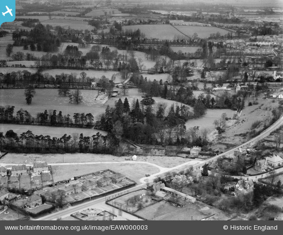
EAW000003 ENGLAND (1946). St David's Drive, Barclay Park and environs, Hoddesdon, 1946
© Copyright OpenStreetMap contributors and licensed by the OpenStreetMap Foundation. 2026. Cartography is licensed as CC BY-SA.
Nearby Images (2)
EAW000003

EAW000002

Details
| Title | [EAW000003] St David's Drive, Barclay Park and environs, Hoddesdon, 1946 |
| Reference | EAW000003 |
| Date | 24-January-1946 |
| Link | |
| Place name | HODDESDON |
| Parish | |
| District | |
| Country | ENGLAND |
| Easting / Northing | 536937, 207980 |
| Longitude / Latitude | -0.015907309792992, 51.753296293 |
| National Grid Reference | TL369080 |
