
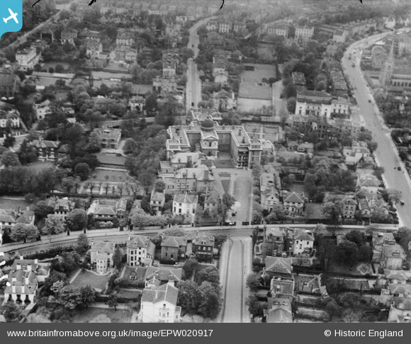
epw020917 ENGLAND (1928). The Hospital of St John and St Elizabeth, St John's Wood, 1928
© Copyright OpenStreetMap contributors and licensed by the OpenStreetMap Foundation. 2025. Cartography is licensed as CC BY-SA.
Nearby Images (13)
EPW020917

EPW020911

EPW020912

EPW020698

EPW020914

EPW020913

EPW020916

EPW020697

EPW020915

EPW020699

EAW044241

EAW018356

EPW045411

Details
| Title | [EPW020917] The Hospital of St John and St Elizabeth, St John's Wood, 1928 |
| Reference | EPW020917 |
| Date | April-1928 |
| Link | |
| Place name | ST JOHN'S WOOD |
| Parish | |
| District | |
| Country | ENGLAND |
| Easting / Northing | 526684, 183157 |
| Longitude / Latitude | -0.17336851300469, 51.532608025221 |
| National Grid Reference | TQ267832 |
Pins
Be the first to add a comment to this image!