
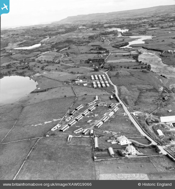
XAW019066 IRELAND (1948). Cementation Co. Works, Ballyshannon, Donegal, Ireland, 1948. Oblique aerial photograph taken facing East.
© Copyright OpenStreetMap contributors and licensed by the OpenStreetMap Foundation. 2024. Cartography is licensed as CC BY-SA.
Nearby Images (26)
XAW019066

XAW019059

XAW019063

XAW009863

XAW019062

XAW019052

XAW009862

XAW027551

XAW019071

XAW027540

XAW019088

XAW009861

XAW019081

XAW027546

XAW027558

XAW027545

XAW009857

XAW027547

XAW019042

XAW027555

XAW019084

XAW027548

XAW027549

XAW009856

XAW009867

XAW027542

Details
| Title | [XAW019066] Cementation Co. Works, Ballyshannon, Donegal, Ireland, 1948. Oblique aerial photograph taken facing East. |
| Reference | XAW019066 |
| Date | 21-September-1948 |
| Link | |
| Place name | BALLYSHANNON |
| Parish | IRELAND |
| District | |
| Country | IRELAND |
| Easting / Northing | 638, 529312 |
| Longitude / Latitude | -8.172049, 54.501231 |
| National Grid Reference |
Pins
Be the first to add a comment to this image!


