
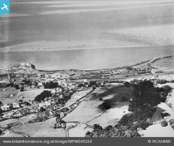
WPW045150 WALES (1934). General view of Mostyn, Flintshire. Oblique aerial photograph, 5"x4" BW glass plate.
© Copyright OpenStreetMap contributors and licensed by the OpenStreetMap Foundation. 2024. Cartography is licensed as CC BY-SA.
Nearby Images (17)
WPW045134

WPW045135

WPW045136

WPW045137

WPW045138

WPW045139

WPW045140

WPW045141

WPW045142

WPW045150

WPW045151

WPW045152

WPW045153

WPW045154

WPW045155

WPW045156

WPW055767

Details
| Title | [WPW045150] General view of Mostyn, Flintshire. Oblique aerial photograph, 5"x4" BW glass plate. |
| Reference | WPW045150 |
| Date | 1934 |
| Link | Coflein Archive Item 6423310 |
| Place name | |
| Parish | |
| District | |
| Country | WALES |
| Easting / Northing | 316070, 380330 |
| Longitude / Latitude | -3.2599052538566, 53.312973713924 |
| National Grid Reference | SJ161803 |
Pins
Be the first to add a comment to this image!


