
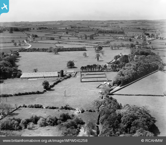
WPW041258 WALES (1933). View of Prince of Wales Hospital, Cowbridge, oblique aerial view. 5"x4" black and white glass plate negative.
© Copyright OpenStreetMap contributors and licensed by the OpenStreetMap Foundation. 2024. Cartography is licensed as CC BY-SA.
Nearby Images (6)
WPW041256

WPW041257

WPW041258

WPW041259

WPW041260

WPW041261

Details
| Title | [WPW041258] View of Prince of Wales Hospital, Cowbridge, oblique aerial view. 5"x4" black and white glass plate negative. |
| Reference | WPW041258 |
| Date | 1933 |
| Link | Coflein Archive Item 6369747 |
| Place name | |
| Parish | |
| District | |
| Country | WALES |
| Easting / Northing | 297230, 174220 |
| Longitude / Latitude | -3.4793551615552, 51.457129723211 |
| National Grid Reference | SS972742 |
Pins
User Comment Contributions
Crossways Manor looking West towards Llyswyrny/Llysworney. Llantwit Major Road is on the left. |
 Class31 |
Wednesday 25th of July 2012 10:08:16 AM |


