
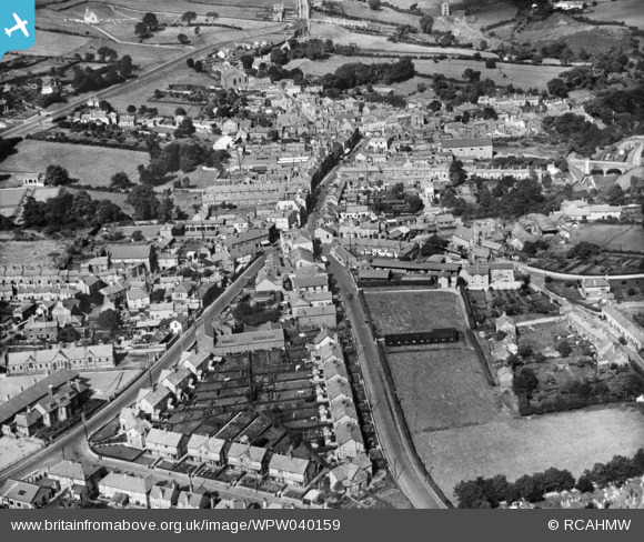
WPW040159 WALES (1932). View of Holywell, oblique aerial view. 5"x4" black and white glass plate negative.
© Copyright OpenStreetMap contributors and licensed by the OpenStreetMap Foundation. 2024. Cartography is licensed as CC BY-SA.
Nearby Images (7)
WAW033867

WAW033871

WAW033874

WPW040158

WPW040159

WPW040160

WPW040161

Details
| Title | [WPW040159] View of Holywell, oblique aerial view. 5"x4" black and white glass plate negative. |
| Reference | WPW040159 |
| Date | 1932 |
| Link | Coflein Archive Item 6369730 |
| Place name | |
| Parish | |
| District | |
| Country | WALES |
| Easting / Northing | 318540, 375940 |
| Longitude / Latitude | -3.2217100946021, 53.273903356635 |
| National Grid Reference | SJ185759 |
Pins
 russyoung |
Friday 31st of July 2020 09:05:26 AM | |
 Class31 |
Monday 4th of March 2013 10:56:37 PM | |
Class31 |
Monday 4th of March 2013 10:55:53 PM | |
Class31 |
Monday 4th of March 2013 10:55:09 PM | |
Class31 |
Monday 4th of March 2013 05:30:24 PM |


