
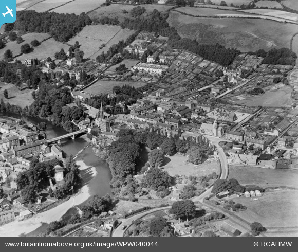
WPW040044 WALES (1932). General view of Newtown, oblique aerial view. 5"x4" black and white glass plate negative.
© Copyright OpenStreetMap contributors and licensed by the OpenStreetMap Foundation. 2024. Cartography is licensed as CC BY-SA.
Nearby Images (5)
WPW040044

WPW040045

WPW040046

WPW040047

WPW040048

Details
| Title | [WPW040044] General view of Newtown, oblique aerial view. 5"x4" black and white glass plate negative. |
| Reference | WPW040044 |
| Date | 1932 |
| Link | Coflein Archive Item 6369657 |
| Place name | |
| Parish | |
| District | |
| Country | WALES |
| Easting / Northing | 310856, 291610 |
| Longitude / Latitude | -3.3137939736171, 52.514711565539 |
| National Grid Reference | SO109916 |
Pins
 gordon |
Friday 26th of April 2013 10:06:13 PM | |
 Class31 |
Wednesday 31st of October 2012 05:00:10 PM | |
Class31 |
Wednesday 31st of October 2012 04:59:26 PM | |
Class31 |
Wednesday 31st of October 2012 04:51:52 PM | |
Class31 |
Wednesday 31st of October 2012 04:51:06 PM | |
Class31 |
Wednesday 31st of October 2012 04:48:35 PM |


