
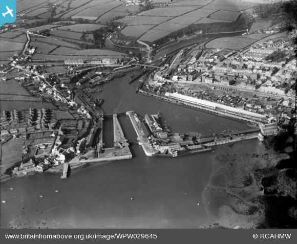
WPW029645 WALES (1929). View of Milford Haven and docks, oblique aerial view. 5"x4" black and white glass plate negative.
© Copyright OpenStreetMap contributors and licensed by the OpenStreetMap Foundation. 2024. Cartography is licensed as CC BY-SA.
Nearby Images (24)
WPW006984

WPW006985

WPW006986

WPW006987

WPW006988

WPW006989

WPW006990

WPW006991

WPW006992

WPW006993

WPW006994

WPW006995

WPW029623

WPW029624

WPW029633

WPW029634

WPW029635

WPW029636

WPW029637

WPW029639

WPW029641

WPW029642

WPW029644

WPW029645

Details
| Title | [WPW029645] View of Milford Haven and docks, oblique aerial view. 5"x4" black and white glass plate negative. |
| Reference | WPW029645 |
| Date | 1929 |
| Link | Coflein Archive Item 6370589 |
| Place name | |
| Parish | |
| District | |
| Country | WALES |
| Easting / Northing | 190303, 205971 |
| Longitude / Latitude | -5.0357893607148, 51.712751699674 |
| National Grid Reference | SM903060 |
Pins
Be the first to add a comment to this image!


